Collection components

The Perthes Collection consists of
- the Map Collection,
- the Library of the Publishing House and
- the Archive of the Publishing House.
Numerous printing plates, predominantly copper plates, are preserved in the archive as outstanding examples of map production techniques. These are supplemented by the holdings of the Editorial Library and the editorial body of the Gothaischer Hofkalender (Gotha Court Calendar). Another of the Collection’s special holdings is the Henze Library.
Since the original arrangement of the Collection was based on the output of the publishing house, materials from other areas are also present in each section of the Collection.
Map Collection
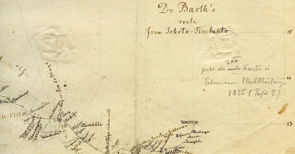
The Map Collection comprises approx. 185,000 map folios, including 11,500 navigational marine charts and 3,450 folded or rolled wall maps for schools.
The Collection includes
- world maps from the late 18th century to the end of the 20th century, which were collated to produce the company’s own maps, and which bear numerous annotations handwritten by Perthes cartographers.
- Perthes maps in all stages of production – from their draft versions through to their final printed format.
The Collection is arranged according to an old system which was used at the end of the 19th century. It indexes the holdings in 550 geographical and regional groups.
The holdings of the Map Collection have been preserved under the Map Cleaning project, and their historical organisational system has been reconstructed. Map holdings already processed by the project may be used on request.
Primary accession code
Gotha Research Library, Perthes Collection Map Collection
abbreviated to: FBG SPK
Library of the Publishing House
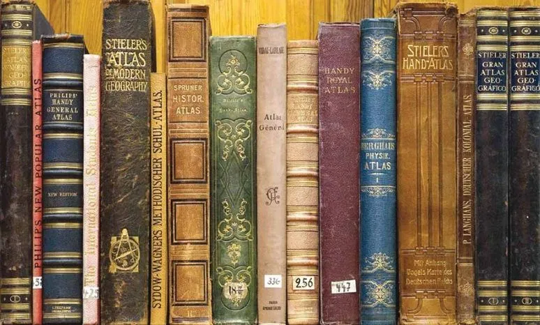
The Library of the Publishing House contains 124,000 volumes that date from the middle of the 18th century to the end of the 20th century. It was established as a working library, closely linked to the work of the publishing house, covering cartography, geography and genealogical statistics.
- Library of Cartography and Geography
The Library of Cartography and Geography, housing 120,000 volumes, constitutes the main section of the Library of the Publishing House. It is based on the private libraries of the publishing house staff and the new publications and review copies sent to the editorial body of “Petermanns Geographische Mitteilungen” (“Petermann’s Geographical Observations”). In addition to monographs and periodicals, it contains 2,200 atlases and 800 shorter compilations. Specialist periodicals make up 40% of the holdings. - Genealogical statistics book collection
The collection of books used for the production of the Gothaischer Hofkalender (Gotha Court Calendar) and genealogical pocket books comprises a sub-holding of 4,000 volumes. The main part of the Hofkalender library was integrated into the specialist Genealogy/Statistics sections of the Gotha Research Library as early as the late 1940s.
The Library of the Publishing House is indexed using pre-digital retrieval resources (alphabetical card catalogue, systematic volume catalogue). The Library of the Publishing House and the Perthes holdings in the specialist Genealogy/Statistics sections of the Research Library have been entered in online databases as part of a cataloguing project. The catalogued holdings can be reserved online and used in the special reading room of the Gotha Research Library.
Primary accession codes
- Library of Cartography and Geography:
Gotha Research Library, Perthes Collection Library
abbreviated to: FBG SPB - Genealogical statistics book collection:
Gotha Research Library, Perthes Collection Library Genealogy
abbreviated to: FBG SP
Archive of the Publishing House
The Archive spans 800 metres. It incorporates the archived material of the publishing house established in 1785, a collection of specimen copies of publications and artefacts relating to map production. Information regarding holdings that can already be utilised is available on request. As of April 2012, the Archive of the Perthes Collection can also be accessed via the Thuringia Archive portal (Archivportal Thüringen).
Archived material
The archived material comprises
- the historical archive of the Justus Perthes Verlag (Justus Perthes publishing house) 1785–1953
- holdings of the VEB Hermann Haack Geographisch-Kartographische Anstalt Gotha (VEB Hermann Haack Institute of Cartography and Geography, Gotha) 1953–1992
- part of the holdings of the Geographische Verlagsanstalt Justus Perthes Darmstadt (Justus Perthes Geographic Publishing House, Darmstadt) 1953–1992
The historical Archive of the Justus Perthes Publishing House covers approx. 120 metres. The holdings are sub-divided into five sections:
- Editorial body of “Petermanns Geographische Mitteilungen” (PGM) (“Petermann’s Geographical Observations”): correspondence, parts of the estates of cartographers, geographers and explorers of the 19th and 20th centuries
- Staff and friends of the publishing house: correspondence, portions of the estates of staff members and authors published by the publishing house, collections of individual publications
- Company and family archive: archived material specific to the management and administration of the publishing house, private family documents, bequests to family foundations
- Image archive covering company and family history
- Editorial body of the Gothaischer Hofkalender (Gotha Court Calendar): archived material relating to the publications on genealogical statistics: Gothaischer Hofkalender (Gotha Court Calendar), Almanach de Gotha (Gotha Almanac), genealogical pocket books, collections of coats of arms.
The holdings of the “PGM Editorial Body”, “Staff and Friends of the Publishers” and “Editorial Board of the Gotha Court Calendar” may be used on request in the special reading room of the Gotha Research Library. The “Family and Friends Archive” and the “Image Archive” are currently being indexed as part of a three-year project.
Publications
Large numbers of specimen copies of publications in the areas of cartography, geography and geography for schools are available in the Archive. These include topographical and thematic atlases and cartography, individual maps, monographs and periodicals. The publications were entered in online databases in the course of a cataloguing project conducted in 2007/2008. The catalogued holdings can be reserved online and used in the special reading room of the Gotha Research Library.
Artefacts
Numerous artefacts from the map-making activities of the publishing house are preserved in the Archive; they include tools used by copper engravers and lithographers, equipment from the workplace and printing plates, in particular copper plates.
Primary accession code
Gotha Research Library, Perthes Collection Archive
abbreviated to: FBG SPA
Archive sub-accession codes:
Publishers’ products:
- SPA
- SPA KART
Archived material
- SPA ARCH PGM (editorial body of “Petermanns Geographische Mitteilungen”)
- SPA ARCH MFV (Staff and Friends of the Publishing House)
- SPA ARCH FFA (Company and Family Archive)
- SPA ARCH BA (Image Archive)
- SPA ARCH Gen (editorial body of the “Gothaischer Hofkalender”)
- SPA ARCH HHG (VEB Hermann Haack, Gotha)
- SPA ARCH JPD (Justus Perthes, Darmstadt)
Copper plates
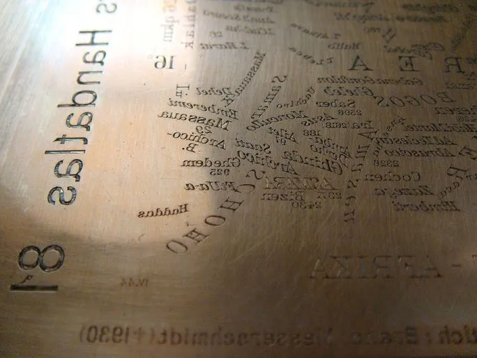
The Perthes Collection Archive contains a collection of 1,650 copper plates. The copper plates of each of the last editions of the publications, made using copperplate engraving, have been preserved almost in their entirety.
Copper plates for the following atlases and collections of maps have been preserved:
- Stielers Handatlas (Stieler’s Hand-Atlas)
- Berghaus’ Physikalischer Atlas (Berghaus’ Physical Atlas)
- Spruner-Menke, Historisch-Geographischer Handatlas (Historical Geographical Hand Atlas)
- Perthes pocket atlases
- van Kampen, Atlas antiquus
- Sydow-Wagner, Methodischer Schulatlas (Methodical School Atlas)
- Vogels Karte des Deutschen Reiches (Vogel’s Map of the German Empire) (27-folio edition; 33-folio edition)
- Vogels Karte von Mitteleuropa (Vogel’s Map of Central Europe) (general edition / flyer map)
- Berghaus’ Map of the World
- Maps for the Encyclopaedia Britannica
- Globes
The holdings are currently being processed in an indexing project.
The copper plates for “Stielers Handatlas” (9th, 10th and 11th / international edition) have been entered in online databases as part of the publications cataloguing project. This holding can be researched online and used on request.
State of preservation of the copper plates
The majority of the plates are in good condition. A small proportion of the holdings has been significantly damaged as a result of inappropriate storage and ageing. An innovative damage assessment and restoration technique has therefore been developed in collaboration with the Faculty of Civil Engineering and Conservation/Restoration at the University of Applied Sciences in Erfurt (Fachhochschule Erfurt, Fachbereich Konservierung/Restaurierung); this is currently being implemented. Information about the restoration project is available in the Projects section.
Primary accession code
Gotha Research Library, Perthes Collection Archive Copper Plate
abbreviated to: FBG SPA.Cu
The GOTHA
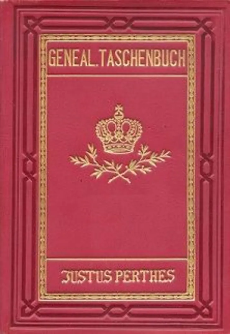
The holdings of the Gothaischer Hofkalender (Gotha Court Calendar), the Almanach de Gotha (Gotha Almanac) and the Genealogischen Taschenbücher des Adels (Genealogical Pocket Books of the Nobility) do not constitute an independent component of the Perthes Collection. The archived editorial material is kept in the Archive of the Publishing House. Part of the Editorial Library is housed in the Library of the Publishing House but the main part of it was incorporated into the Genealogy/Statistics sections of the Gotha Research Library as long ago as the late 1940s.
The holdings of the Editorial Library have been recorded in online databases in the course of a cataloguing project. They can be reserved online and used in the special reading room of the Gotha Research Library.
Primary accession codes
Sub-holding of the Editorial Library in the Library of the Publishing House:
Gotha Research Library, Perthes Collection Genealogy
abbreviated to: FBG SPG
The main part of the Editorial Library holdings, which is part of the Genealogy/Statistics sections of the Gotha Research Library, uses accession codes from the system of the duke’s collection.
Henze Library
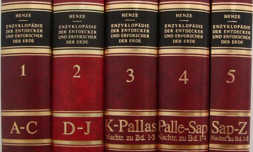
In 2006, in an initiative to expand and raise the profile of the Perthes Collection, the Research Library acquired the working library of the geographer Dietmar Henze, author of the five-volume “Enzyklopädie der Entdecker und Erforscher der Erde” (“Encyclopaedia of the Earth’s Discoverers and Explorers”) (1978-2004, with a supplementary volume in 2011). The unique special collection focusing on the history of geography in the 19th and 20th centuries is currently being integrated into the Perthes Collection.
The book holdings of the working library can be reserved online and used in the special reading room of the Research Library. The archival holdings of the working library can be viewed in the special reading room, insofar as they are usable.
Primary accession code
Gotha Research Library, Dietmar Henze Library
abbreviated to: FBG BDH

![[Translate to English:] facebook icon](/fileadmin/SocialMediaIcons/iconfinder_06-facebook_white.svg)
![[Translate to English:] instagram icon](/fileadmin/SocialMediaIcons/iconfinder_38-instagram_white.svg)
![[Translate to English:] YouTube icon](/fileadmin/SocialMediaIcons/iconfinder_18-youtube_white.svg)
![[Translate to English:] xing icon](/fileadmin/SocialMediaIcons/iconfinder_xing_white.svg)