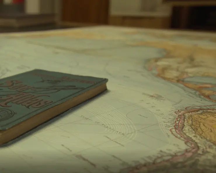
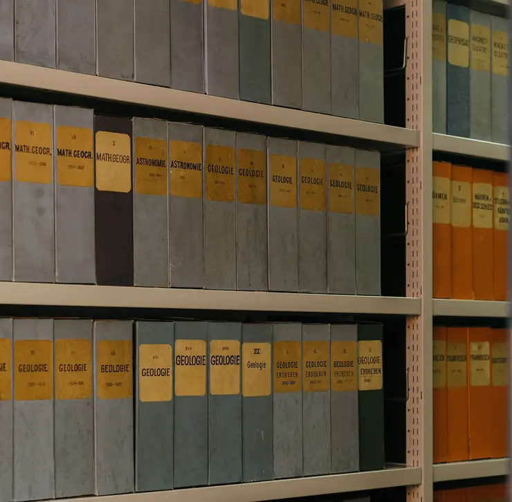
Mappings: Historical Knowledge Research and New Cartographic History
The Mappings seminar began in the summer semester of 2014 as a research seminar and has since been continued as a recurring series. It functions as a seminar for Master's students, doctoral candidates and postdoctoral researchers as well as a colloquium for Herzog Ernst Scholarship holders. The seminar is dedicated to do research on the Gotha Perthes Collection as well as current trends in historical knowledge research, the methodological challenges of collection research and approaches to the new history of cartography.
Cartographies of the Frontier in the 19th Century. A Research Seminar on Working with Historical Maps (summer semester 2025)
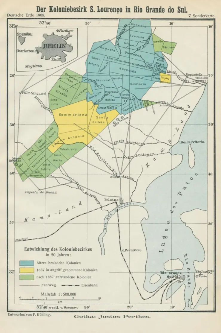
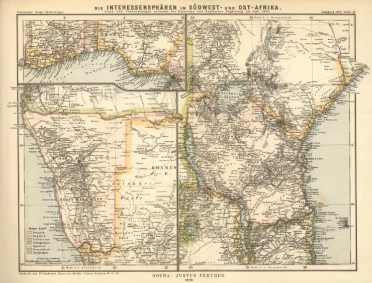
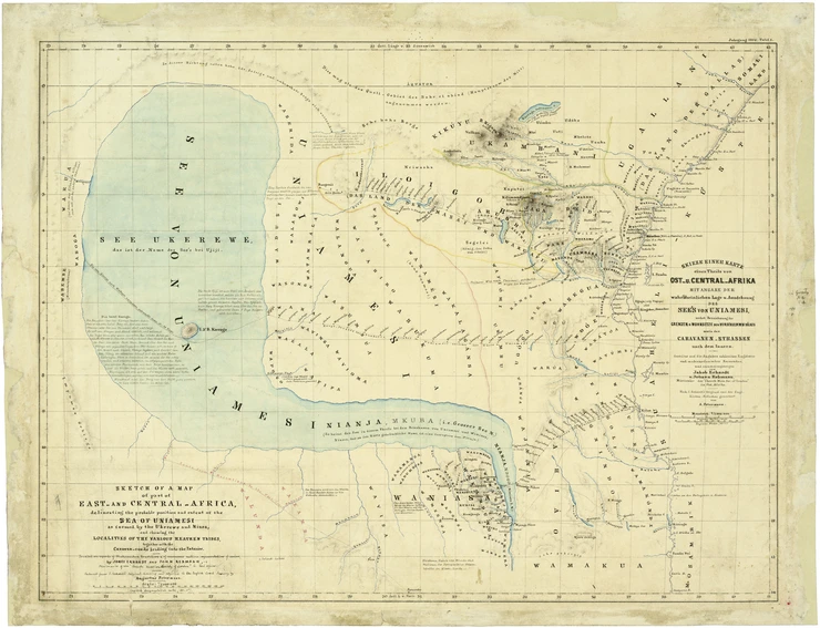
Frontiers can be understood as political borders of their own kind. Contrary to popular belief, they did not only exist in the course of the conquest of the US West (Turner). Rather, frontiers in other regions of the world were linked to global migration. In the 19th century, the focus was often on European colonial land seizures, in which the associated settlement movements attempted to forcibly appropriate supposedly uninhabited territories. The renewed efforts to create a "German East" since around the middle of the century can also be seen as an example of this. The respective border between the claimed territory and the as yet unclaimed parts was always fragile and did not run in a linear fashion: instead, settlement projects in many places were often only accompanied by isolated "islands of rule" (Pesek). This seemingly sporadic presence was diametrically opposed to the claim to territorial sovereignty. The research seminar takes up these historical contexts and examines the significance of maps that visualised the frontiers both memorably and in very different ways. It traces the history of European settlements - following the interests of the participants - using case studies of South, North and East Africa, Brazil, Argentina and parts of Eastern Europe. According to the initial observation, maps accompanied the desired appropriation of land and made the colonial appropriation that went hand in hand with it not only clear, but also seem unproblematic - despite the often violent policies of conquest. The research seminar offers a thematically focussed introduction to the critical history of cartography and at the same time an introduction to research with the collections of the Gotha Perthes Collection (Gotha Research Library).
Maps - Knowledge - Borders. A Research Seminar on the Perthes Collection (summer semester 2024)
The "age of territoriality", the age of fixed, self-contained political spaces seems to have returned to an astonishing extent. Organising political spaces, dividing them and drawing borders is obviously part of the agenda. Political borders are made relevant, fortified as much as possible, equipped, monitored and defended at great technical expense. Against the backdrop of global migration movements, the focus is increasingly on compartmentalisation. Moreover, the belief in the inviolability of existing borders, which was previously widely shared in Europe, has now begun to waver, as wars are once again being fought over territories and the associated national sovereignty. Political borders are therefore in fashion. The research seminar focussed on their long history, starting in the late 18th century. It aimed to lend historical depth to the debate, which is often only conducted with a view to current developments, in order to develop a more complex understanding of political spaces, borders and border regimes in their historical changeability. The seminar focussed on bordermaking processes using selected studies on Europe, Africa, Latin America and the Pacific. In the sense of a critical cartographic history, it also dealt with "drawing borders on paper", including its various manifestations and the associated conflicts. The seminar took place at the Centre for Transcultural Studies (Gotha Research Campus) and on selected dates directly in the Gotha Perthes Collection (Gotha Research Library).
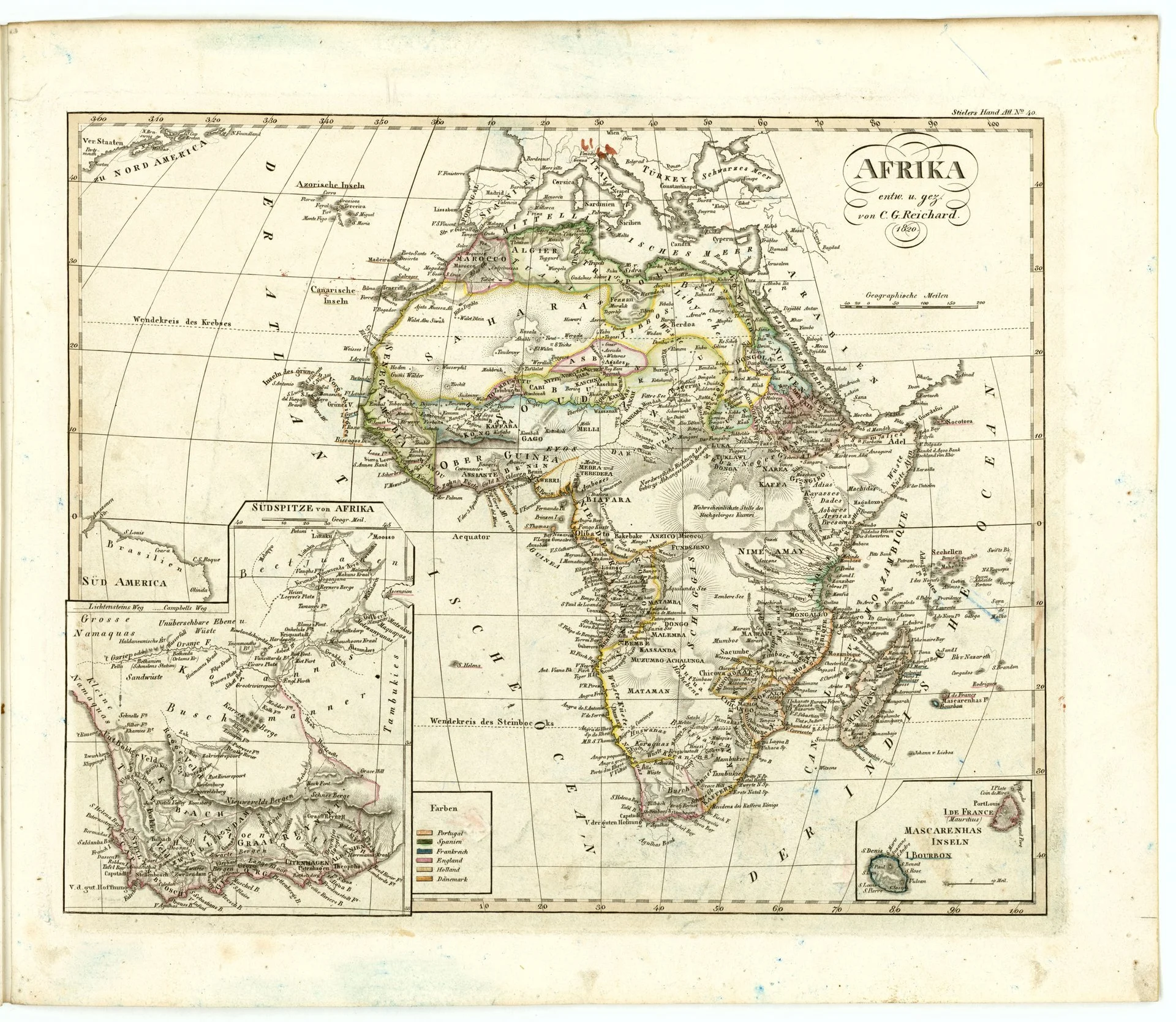
Historical Cartographies of Africa – Transcultural. A Research Seminar on the Gotha Perthes Collection (summer semester 2023)
Historical maps of Africa from the 19th and 20th centuries have long been read as technical artefacts of an all-encompassing European superiority. In particular, those maps that accompanied the later colonial land conquest are still often read in research as simple "tools of empire". The research seminar for Erfurt History Master's students took these assumptions as its starting point, but attempted to develop a different, postcolonially informed reading by focussing on the "African agency" of mapping on site: using the extensive holdings of African maps preserved in the Gotha Perthes Collection, the seminar developed new transculturally inspired map readings that focused in particular on the historical interaction of African and European spatial and mapping practices on site. Using the example of Ethiopia, the seminar also discussed the potential of historical maps in recent African historiography in dialogue with Ethiopian visiting scholars working in Gotha. The research seminar took place at the Gotha Research Campus, in the Centre for Transcultural Studies / Perthes Collection (Gotha Research Library), and on selected dates directly in the library.
The Gotha Perthesverlag and its Successors in the Upheavals of the 20th Century. A Research Seminar (summer semester 2021 and winter semester 2021/22)
In the summer of 2021, students that are part of the Erfurt Master's degree programmes "Collections-Based History of Knowledge and Culture" (SWK), "Transcultural History" and "MESH" (Middle Eastern Sociology and History) began a two-semester research seminar on the history of publishing under the direction of Iris Schröder and Christiane Kuller with the aim of testing new approaches to broad-based publishing research with a view to the tradition in the Gotha Perthes Collection. Discussions centred on publishing activities in the immediate aftermath of the First World War, during the National Socialist era and the Second World War, as well as in the changing contexts of the Cold War, with questions of German and German-German history, not least in their respective global contexts – combined with (post-)colonial approaches – were on the agenda. In the first part of each semester, the thematic foundations were developed using selected relevant texts and the basic handling of archive materials in the collections was practised. Participants were then asked to prepare their own source-based case studies based on selected holdings. The seminar initially took place fortnightly; in the second part, participants worked individually on material from the Gotha Perthes Collection and then presented and discussed the results with the seminar group in a joint block event.
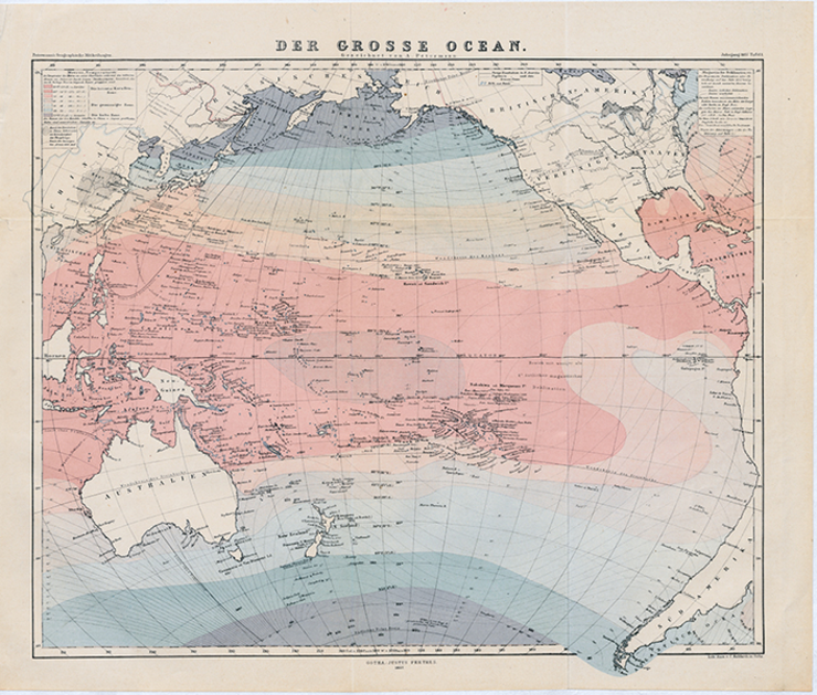
Maps and Oceans. A Research Seminar on Working with Historical Sea Charts and Ocean Maps (winter semester 2019/20)
As part of a course for the master's programme "Collections-Based History of Knowledge and Culture" a research seminar on the Gotha Perthes Collection was held in the 2019/20 winter semester in cooperation with the BMBF research network “Maps - Oceans. For a history of globalisation from the water”. In the first part of the seminar, under the direction of Iris Schröder and Felix Schürmann, selected thematically relevant aspects of the history of cartography, spatial theory and marine history were developed and the basic handling of historical map material was practised. The participants were then asked to prepare their own source-based case studies using selected items from the Gotha Perthes Collection. The seminar initially took place fortnightly; in the second part, participants worked individually on material from the Gotha Perthes Collection. The results were then presented to the seminar group in a joint block event.
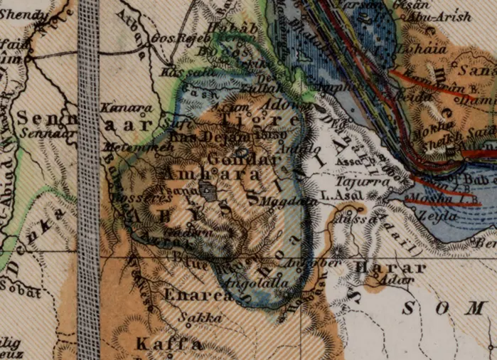
The Holy Land in Africa: The Gotha Cartography of Abyssinia. A Research Seminar on the Perthes Collection (summer semester 2016)
A research seminar on the Gotha Perthes Collection with the title "The Holy Land in Africa: The Gotha Cartography of Abyssinia" took place in the summer semester of 2016 as part of a course for the master's programme "Collections-Based History of Knowledge and Culture".
In the first part of the seminar, under the direction of Iris Schröder, Wolbert Smidt and Fesseha Berghe, selected thematically relevant parts of the history of cartography and spatial theory were developed and the basic handling of historical map material was practised. The participants were then asked to prepare their own source-based case studies using selected items from the Gotha Perthes Collection. The seminar initially took place fortnightly; in the second part, participants worked individually on material from the Gotha Perthes Collection. The results were then presented to the seminar group in a joint block event.
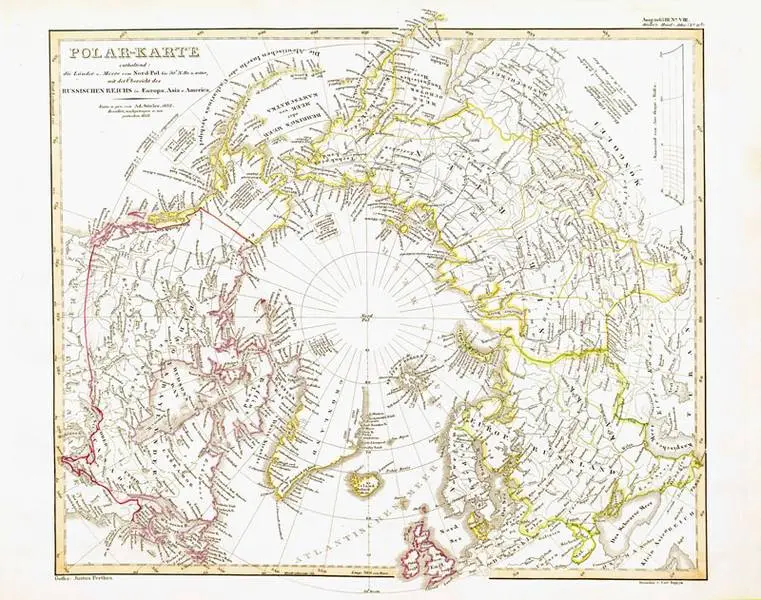
Polarising Knowledge: Mapping the Arctic. A Research Seminar on the Gotha Perthes Collection (winter term 2015/16)
As part of a course for the master's programmes "History" and "Collections-Based History of Knowledge and Culture", a research seminar on the Gotha Perthes Collection was held in the winter semester 2015/16 with the title “Polarising knowledge: Mapping the Arctic”.
Under the direction of Iris Schröder, the students explored the mapping of the Arctic in the 19th and 20th centuries. In the first part of the seminar, selected thematically relevant parts of the history of cartography and spatial theory were developed and the basic handling of historical map material was practised. The participants were then asked to prepare their own source-based case studies using selected items from the Gotha Perthes Collection. The seminar initially took place on a weekly basis; in the second part, participants worked individually on material from the Gotha Perthes Collection. The results were then presented to the seminar group on a joint block seminar day in January.
The Scramble for Africa as a Cartographic Project. A Research Seminar (winter semester 2013/14)
Representatives from 14 European states and the USA met at the Berlin Congo Conference in 1884/85 at the invitation of German Chancellor Otto von Bismarck. Officially, the conference was about freedom of trade in the Congo and Niger as well as agreements regarding further colonial acquisitions by the European powers. The final document, the Congo Act, finally gave the starting signal for the future territorial division of Africa among the European colonial powers.
The first part of the seminar was dedicated to the aforementioned political events between the 1880s and the outbreak of the First World War. In the second part of the seminar, the cartographic project accompanying the "Scramble for Africa" was examined in more detail, reaching for the contemporary maps held in the Gotha Perthes Collection. The first half of the seminar took place weekly on the Erfurt campus. The second half of the seminar was held in parts as a block seminar and at the Perthes Collection and the Gotha Research Centre. A reader was made available at the beginning.

![[Translate to English:] facebook icon](/fileadmin/SocialMediaIcons/iconfinder_06-facebook_white.svg)
![[Translate to English:] instagram icon](/fileadmin/SocialMediaIcons/iconfinder_38-instagram_white.svg)
![[Translate to English:] YouTube icon](/fileadmin/SocialMediaIcons/iconfinder_18-youtube_white.svg)
![[Translate to English:] xing icon](/fileadmin/SocialMediaIcons/iconfinder_xing_white.svg)