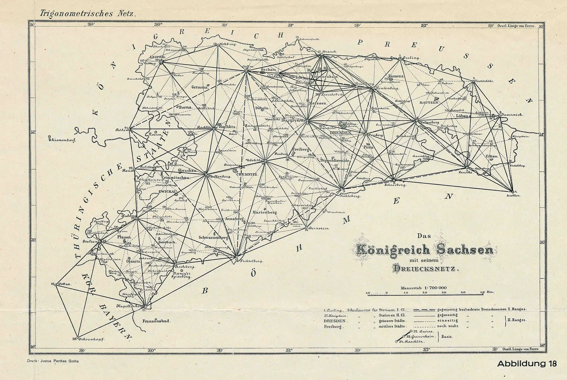
According to earlier Saxon topographical surveys, following the Congress of Vienna in 1815, Prussia, Saxony and Austria-Hungary undertook major efforts to improve the cartographic basis of Central Europe. Saxony joined the Central European Grad Measurement, initiated by Prussia, in 1862. From 1864 onwards, a trigonometric control network was established – initially a coarser-meshed first-order triangulation network comprising a total of 36 stations as measurement points. This included, amongst others, the stations at Porsberg, Baeyerhöhe, Valtenberg and Keulenberg. This network was densified to second-order status with a further 122 stations, including Gohlig, Wilisch, Klingenberg, Opitzhöhe and the Hausmann Tower in Dresden Castle.
The greatest achievement in the field of surveying was the precise determination of the Großenhain baseline in 1872, which served as the reference line for the triangulation. Certificates of this survey are still visible today. This is because the stations were marked by stone observation pillars, known as ‘Nagel’s pillars’, which are now listed as historic monuments. They are named after their creator, the Dresden professor of geodesy, who headed the geodetic work for the state survey. In their talk, Birgit and Ralph Buder explore numerous questions, including what triangulation actually is, which surveying methods were used for it, and who the initiators and masterminds behind the triangulation projects were.
The speakers
Birgit Buder studied mining surveying at the Freiberg University of Mining and Technology and surveying at HTW Dresden. She works at the Saxony State Office for Geobasis Information – GeoSN. Ralph Buder studied electrical power engineering at TU Dresden and worked in the energy supply sector for more than 30 years.
Following the lecture, the Research Library invites attendees to join in further discussions. A small reception hosted by the Friends of the Gotha Research Library e.V. will round off the evening.